|
Hot tours
Site map
Main menu
Weather in Tajikistan
Hotels booking
Airlines Schedule
Tajik air company schedule
Somon air schedule
Uzbek Havo Yullary - Uzbekistan Airline Schedule
Kazakh air company schedule - Almaty ALA Flights Airport Schedule
Kyrgyz aie company schedule - Kyrgyzstan Bishkek Central Asia Airport - flight schedule
Turkmenistan airlines Schedule - Satans tour Turkmenistan airlines Schedule
Search
|
ABOUT GREAT SILK ROADSOGDIANS ON THE GREAT SILK ROAD
Among the nations of Central Asia Tajiks have more deep historical roots, and naturally these roots take them to the history of Great Silk Road. From many centuries people were connected with each others Great Silk Road stretching from South-East Asia to the countries of Mediterranean. This name was founded by the German geographer and the historian of the XIX cc Ferdinand von Richthofen. However caravans of camels carried not only silk, for centuries from the East to the West and from the West to East they carried a great amount of raw materials and goods made from: bronze, porcelain, wool, cobalt. Besides that, the silk roads served as a channel for spreading the ideas, technologies, art and religions, promoting mutual enrichment of cultures and formation of a common legacy of mankind. According to the analysis of the historians and the archeologists the Great Silk Road has about 300o years of history. The main well-studied part of the road stretched from Italy via Turkey to Iraq and Iran, where wells and reservoirs for caravans and merchants were built; then the road led to Central Asia and over Pamirs to Kashgar and Yarkend (China)where it divided into two, passing round Takla – Makan desert from the North and the South, and met near Lobnor Lake, then it went to steppes inhabited by nomadic people and further to China. Only in this Middle Part – Central Asia – the Silk Road got narrow and further nearer to the end it divided into many paths which led to different cities and countries. From one side they ended near the shores of Ireland and Norwegian fiords, in Portugal and Denmark, Suzdal and the Ural (Russia) from the other side it stretched to Japan (Nara), to the Spices Island behind Indonesia, to Ceylon and Philippines. Terefore, some parts of Great Silk Road passed through the territory of modern Tajikistan, These branches are as follows: First route – “Sogdian”. “Kokand – Isfara – Kanibadam – Istaravshan – Bunjikat – Varziminor – Penjikent – Zeravshan – Anzob - Dushanbe”. This route starts at the western edge of the Ferghana Valley, in times it was called by Chinese as “Davan”. Ancient times it was the place of “Heavenly horses” and the famous traditional black and white skullcaps of “Chusti”, which is now popular in all Central Asia. A chain of cities (Kashgar, Osh, Andijan, Ferghana and Kokand) lied this section of the route to Isfara. This city first was mentioned in the famous book of Babur “Baburnama”. In the first millennium B.C , the Iranian speaking Sakas built numerous burial grounds with kurgans, or mounds, over the graves.Isfara and nearby villages are also the sites of many monuments of architecture, archeology and art. One of such monuments is in the village of Navgilem, where it is possible to see the mosque of Abdullakhan, built by the order of Sheybany Abdullakhan in XVI cc. South of Isfara, the village named Chorku, is surrounded by ancient structures, the mazar Khazrati Shakh – the only existing wooden mausoleum with extremely beautiful architecture. The next city is Kanibadam (city of Almonds). In written history, Kanibadam or Kand was mentioned in Sogdian documents found in upper Zeravshan, on Mug mountains (712-714). In VIII-IX cc Kanibadam was a part of Khujand. In the city center there was situated the medresse of Mirrajab-Dodkho with a charming architecture. Built in XVI-XVII cc it is now used as the museum. The road from Kanibadam to Khujand follows the southern bank of the Kayrakkum water reservoir, which was built in 1956 y, and it covers an area of 520 square kilometers.
In times of Achamenids, Khujand was the eastern bulwark of Persian Empire/ Ancient Greek and Roman authors considered Khujand as the frontier of Asia. Alexander the Great established his camp in this place 2500 years ago, and named the town as “Alexandria Eskhata”(extreme). The ancient historian Arrian mentioned that, in 329 BC by the order of Alexander, the city was surrounded with strong walls. In 1975 archeologists found a fragment of the brick dating back from the V c BC. The citadel of Khujand is located near Sirdarya river, covering an area of 320 by 200 square meters. Its impregnable walls were attacked for many times over the years by the troops of Omeyad Caliphs, Turks and Chenghizkhan. Ancient Khujand, supplied with water by five canals, was encircled by a fortress wall 10,5 km long, with seven gates that opened to main streets leading to the centre of the city. Arabic geographers of the X-XI cc gave the city the flattering name of “Tirozi Jahon”, or “Bride of the World”. In the beginning of the XX c. the city still preserved its oriental Outlook, and consisted of 146 blocks, whose inhabitants were determined by relations or profession. These in turn were concentrated around public and cultural centers such as: 33 Friday and 121 district mosques, more than 100 khauzes (stone lined pools), 37 caravansarays, and 300 chaykhanas (tea-houses). Being a large center of trade and crafts, including silk fabric production, the city possessed ancient scientific and cultural traditions. On the basis of the number of medresse, Khujand ranked third after Bukhara and Samarkand. One of the highlights of Khujand in the city center, near the Panjshanbe bazaar, is the architectural complex of Sheikh Muslihiddin, consisting of mosque, the mausoleum and the minaret. The mausoleum was built in the XI-XII cc., but the existing building was erected in 1394 by order of Timur – a murid (follower) of Sheikh Muslihiddin, and was renowated in XVI cc.the Friday mosque, which was built in XVII-XIX cc., is situated south of the mausoleum, and the 21 ms high minaret was built in 1895.Construction was carried out by master Khoji Rahmat from Khujand and his students from Rumon – the village near Khujand. Twenty two kilometers from Kurkat, the ruins of the Aktepa temple were discovered dating from the IV-VII cc. The structure consists of the central premises, containing the sacred fire, surrounded with corridors on four sides and reinforced with four large corner towers. Istaravshan is the only city in Tajikistan, where the traditional residential environmental has been preserved, with picturesque planning of living areas against the background of monumental structures of the XV-XIX cc.: monuments such as: the mosque and medresse of Kok-Gumbaz, the mausoleums of Bobo Tagho and Chor Gumbaz: and the complexes of Sari Mazor and Khazrati Shah. Istaravshan (formerly Uroteppa) is also famous as the home of woodcarvers and the knife-makers, the embroidery of wall hangings (suzane), and manufacture of fine musical instruments (karnay). Twenty five kilometers from Istaravshan lies the capital of ancient Ustrushana, Bunjikat. During the archeological expedition of professor N.Negmatov, the collapsing palace structures were examined, revealing a large carved wooden Timpan, with scenes of myths from Ustrushana civilization. A fresco on the wall depicting the symbol of the Rome – a she-wolf feeding two children – offers evidence of contacts between West and East. At the junction of the Kulkutan and Shakhristansay rivers, the Chilhujra Castle is located. It is possibly the only ancient building still standing, consisting of two floors, with strong walls and reinforced corner towers dating back from IV-VI cc.A.D.
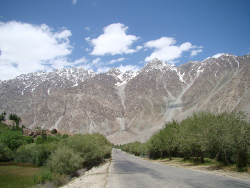
After Shakhristan the road takes towards Shahriston pass with the maximum height of 3351 meters, whose slopes are covered with thick growth of archa (savin) trees. Through the picturesque winding descent of the pass, the road leads to the Zerafshan valley, to Ayni Settlement. The ancient name of the town, Varziminor (“Tall minaret”), as it refers to one of the tallest and ancient minarets in Central Asia. Really, a tall minaret built from the mud bricks with a height of 13,5 meters is still staying here. According to local legend the king Jalalaeddin ordered to build seven minarets in Zerafshan valley, and the three of them are still staying in the villages of Varziminor, Rarz and Fatmev. If to continue this road towards the west the road takes us through the village of Dar-Dar, Zerabad, Iskodar (originating from the ancient sogdian name of “scada - rock”), in the street of Dar-Dar village, the mosque from XIX cc, is the spot for taking photos with its fine wooden carvings and charming ornaments. The next interesting object in our way is the Mount Mug castle, not far from where the Kum river joins Zerafshan river, 3 kilometers from Khayrabad village. More than 80 leather documents found here in 1933 gave a big raise to archeological studies in Pendjikent and in Tajikistan in the whole. Villages of upper Zerafshan are place of perfectly preserved samples of wood carving from IX-XI cc., found in 1930-1950 years.Several pieces, consisting of pillars, consoles from Kurut, Fatmev, Urmetan, Oburdon and Mastchoh villages, and the Central Asia’s masterpiece of carved wood, the wooden mihrab of the X c. from Iskodar village. At the mouth of Zerafshan river, leading into the valley, one can reach to Ancient Penjikent of V-VII cc. – the best studied preislamic Sogdian city, symbolically called as “Pompey of central Asia” . Excavations were carried out here almost a half a century, to study the Sogdian way of life. Ancient Penjikent was dencely covered with two and three storied buildings, with sitting rooms decorated with four pillars and murals. On the hill, surrounded with the protective walls, there was a citadel of ancient Penjikent, prince Divashtich sat in the royal palace. The palace consisted of a complex of halls, beautified with different frescoes and columns. |
Last news
2017-03-08 VIST US AT ITB BERLIN 20172014-03-15 Pamir & mountain travel co.in ITB 20142012-12-06 Super Star Aquarius docks at Chan May port!Tajikistan map
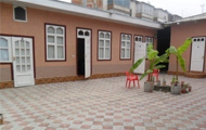
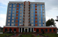
hotels


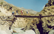
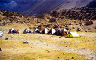
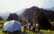
trekking in Fann mountain


transportations


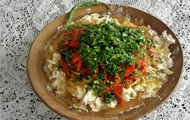
National meal


|


|
Hot tours
Site map
Weather in Tajikistan
Hotels booking
Search
|
ABOUT GREAT SILK ROADSOGDIANS ON THE GREAT SILK ROAD
Among the nations of Central Asia Tajiks have more deep historical roots, and naturally these roots take them to the history of Great Silk Road. From many centuries people were connected with each others Great Silk Road stretching from South-East Asia to the countries of Mediterranean. This name was founded by the German geographer and the historian of the XIX cc Ferdinand von Richthofen. However caravans of camels carried not only silk, for centuries from the East to the West and from the West to East they carried a great amount of raw materials and goods made from: bronze, porcelain, wool, cobalt. Besides that, the silk roads served as a channel for spreading the ideas, technologies, art and religions, promoting mutual enrichment of cultures and formation of a common legacy of mankind. According to the analysis of the historians and the archeologists the Great Silk Road has about 300o years of history. The main well-studied part of the road stretched from Italy via Turkey to Iraq and Iran, where wells and reservoirs for caravans and merchants were built; then the road led to Central Asia and over Pamirs to Kashgar and Yarkend (China)where it divided into two, passing round Takla – Makan desert from the North and the South, and met near Lobnor Lake, then it went to steppes inhabited by nomadic people and further to China. Only in this Middle Part – Central Asia – the Silk Road got narrow and further nearer to the end it divided into many paths which led to different cities and countries. From one side they ended near the shores of Ireland and Norwegian fiords, in Portugal and Denmark, Suzdal and the Ural (Russia) from the other side it stretched to Japan (Nara), to the Spices Island behind Indonesia, to Ceylon and Philippines. Terefore, some parts of Great Silk Road passed through the territory of modern Tajikistan, These branches are as follows: First route – “Sogdian”. “Kokand – Isfara – Kanibadam – Istaravshan – Bunjikat – Varziminor – Penjikent – Zeravshan – Anzob - Dushanbe”. This route starts at the western edge of the Ferghana Valley, in times it was called by Chinese as “Davan”. Ancient times it was the place of “Heavenly horses” and the famous traditional black and white skullcaps of “Chusti”, which is now popular in all Central Asia. A chain of cities (Kashgar, Osh, Andijan, Ferghana and Kokand) lied this section of the route to Isfara. This city first was mentioned in the famous book of Babur “Baburnama”. In the first millennium B.C , the Iranian speaking Sakas built numerous burial grounds with kurgans, or mounds, over the graves.Isfara and nearby villages are also the sites of many monuments of architecture, archeology and art. One of such monuments is in the village of Navgilem, where it is possible to see the mosque of Abdullakhan, built by the order of Sheybany Abdullakhan in XVI cc. South of Isfara, the village named Chorku, is surrounded by ancient structures, the mazar Khazrati Shakh – the only existing wooden mausoleum with extremely beautiful architecture. The next city is Kanibadam (city of Almonds). In written history, Kanibadam or Kand was mentioned in Sogdian documents found in upper Zeravshan, on Mug mountains (712-714). In VIII-IX cc Kanibadam was a part of Khujand. In the city center there was situated the medresse of Mirrajab-Dodkho with a charming architecture. Built in XVI-XVII cc it is now used as the museum. The road from Kanibadam to Khujand follows the southern bank of the Kayrakkum water reservoir, which was built in 1956 y, and it covers an area of 520 square kilometers.
In times of Achamenids, Khujand was the eastern bulwark of Persian Empire/ Ancient Greek and Roman authors considered Khujand as the frontier of Asia. Alexander the Great established his camp in this place 2500 years ago, and named the town as “Alexandria Eskhata”(extreme). The ancient historian Arrian mentioned that, in 329 BC by the order of Alexander, the city was surrounded with strong walls. In 1975 archeologists found a fragment of the brick dating back from the V c BC. The citadel of Khujand is located near Sirdarya river, covering an area of 320 by 200 square meters. Its impregnable walls were attacked for many times over the years by the troops of Omeyad Caliphs, Turks and Chenghizkhan. Ancient Khujand, supplied with water by five canals, was encircled by a fortress wall 10,5 km long, with seven gates that opened to main streets leading to the centre of the city. Arabic geographers of the X-XI cc gave the city the flattering name of “Tirozi Jahon”, or “Bride of the World”. In the beginning of the XX c. the city still preserved its oriental Outlook, and consisted of 146 blocks, whose inhabitants were determined by relations or profession. These in turn were concentrated around public and cultural centers such as: 33 Friday and 121 district mosques, more than 100 khauzes (stone lined pools), 37 caravansarays, and 300 chaykhanas (tea-houses). Being a large center of trade and crafts, including silk fabric production, the city possessed ancient scientific and cultural traditions. On the basis of the number of medresse, Khujand ranked third after Bukhara and Samarkand. One of the highlights of Khujand in the city center, near the Panjshanbe bazaar, is the architectural complex of Sheikh Muslihiddin, consisting of mosque, the mausoleum and the minaret. The mausoleum was built in the XI-XII cc., but the existing building was erected in 1394 by order of Timur – a murid (follower) of Sheikh Muslihiddin, and was renowated in XVI cc.the Friday mosque, which was built in XVII-XIX cc., is situated south of the mausoleum, and the 21 ms high minaret was built in 1895.Construction was carried out by master Khoji Rahmat from Khujand and his students from Rumon – the village near Khujand. Twenty two kilometers from Kurkat, the ruins of the Aktepa temple were discovered dating from the IV-VII cc. The structure consists of the central premises, containing the sacred fire, surrounded with corridors on four sides and reinforced with four large corner towers. Istaravshan is the only city in Tajikistan, where the traditional residential environmental has been preserved, with picturesque planning of living areas against the background of monumental structures of the XV-XIX cc.: monuments such as: the mosque and medresse of Kok-Gumbaz, the mausoleums of Bobo Tagho and Chor Gumbaz: and the complexes of Sari Mazor and Khazrati Shah. Istaravshan (formerly Uroteppa) is also famous as the home of woodcarvers and the knife-makers, the embroidery of wall hangings (suzane), and manufacture of fine musical instruments (karnay). Twenty five kilometers from Istaravshan lies the capital of ancient Ustrushana, Bunjikat. During the archeological expedition of professor N.Negmatov, the collapsing palace structures were examined, revealing a large carved wooden Timpan, with scenes of myths from Ustrushana civilization. A fresco on the wall depicting the symbol of the Rome – a she-wolf feeding two children – offers evidence of contacts between West and East. At the junction of the Kulkutan and Shakhristansay rivers, the Chilhujra Castle is located. It is possibly the only ancient building still standing, consisting of two floors, with strong walls and reinforced corner towers dating back from IV-VI cc.A.D.
After Shakhristan the road takes towards Shahriston pass with the maximum height of 3351 meters, whose slopes are covered with thick growth of archa (savin) trees. Through the picturesque winding descent of the pass, the road leads to the Zerafshan valley, to Ayni Settlement. The ancient name of the town, Varziminor (“Tall minaret”), as it refers to one of the tallest and ancient minarets in Central Asia. Really, a tall minaret built from the mud bricks with a height of 13,5 meters is still staying here. According to local legend the king Jalalaeddin ordered to build seven minarets in Zerafshan valley, and the three of them are still staying in the villages of Varziminor, Rarz and Fatmev. If to continue this road towards the west the road takes us through the village of Dar-Dar, Zerabad, Iskodar (originating from the ancient sogdian name of “scada - rock”), in the street of Dar-Dar village, the mosque from XIX cc, is the spot for taking photos with its fine wooden carvings and charming ornaments. The next interesting object in our way is the Mount Mug castle, not far from where the Kum river joins Zerafshan river, 3 kilometers from Khayrabad village. More than 80 leather documents found here in 1933 gave a big raise to archeological studies in Pendjikent and in Tajikistan in the whole. Villages of upper Zerafshan are place of perfectly preserved samples of wood carving from IX-XI cc., found in 1930-1950 years.Several pieces, consisting of pillars, consoles from Kurut, Fatmev, Urmetan, Oburdon and Mastchoh villages, and the Central Asia’s masterpiece of carved wood, the wooden mihrab of the X c. from Iskodar village. At the mouth of Zerafshan river, leading into the valley, one can reach to Ancient Penjikent of V-VII cc. – the best studied preislamic Sogdian city, symbolically called as “Pompey of central Asia” . Excavations were carried out here almost a half a century, to study the Sogdian way of life. Ancient Penjikent was dencely covered with two and three storied buildings, with sitting rooms decorated with four pillars and murals. On the hill, surrounded with the protective walls, there was a citadel of ancient Penjikent, prince Divashtich sat in the royal palace. The palace consisted of a complex of halls, beautified with different frescoes and columns. |
Last news
2017-03-08 VIST US AT ITB BERLIN 20172014-03-15 Pamir & mountain travel co.in ITB 20142012-12-06 Super Star Aquarius docks at Chan May port!Tajikistan map
hotels
trekking in Fann mountain
transportations
National meal
|