|
Hot tours
Site map
Main menu
Weather in Tajikistan
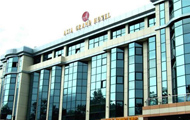
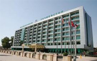
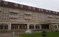
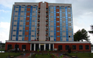
Hotels booking
Airlines Schedule
Tajik air company schedule
Somon air schedule
Uzbek Havo Yullary - Uzbekistan Airline Schedule
Kazakh air company schedule - Almaty ALA Flights Airport Schedule
Kyrgyz aie company schedule - Kyrgyzstan Bishkek Central Asia Airport - flight schedule
Turkmenistan airlines Schedule - Satans tour Turkmenistan airlines Schedule
Search
|
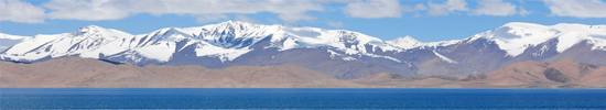
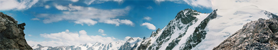
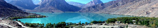
About roof of PamirPamir- "the Roof of the World".
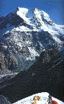
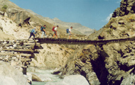
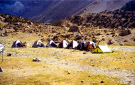
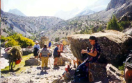
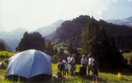
Enclosed between the Alai range to the south and east and by the Tien-Shan range to the north, the Ferghana valley is the fertile hear of these large mountains. When in the 3rd century B.C. the envoys of the Chinese emperor came to this region to see the celebrated Ferghana horses, whose speed was legendary throughout Asia, and to seek allies in order to control the trade routes, the valley had already been intensely cultivated and its towns were the most frequented oasis in the entire Silk Road. The thriving trade along the ancient Silk Road, as well as the many invasions on the part of foreign armies that came to the steppe for booty, developed the complex culture of Central AM. The most ancient inhabitants of this area descended from immigrants who had fled from Persia long before Alexander the Great time; they remained different from the other populations both in their language (which was linked to ancient Persian) and their work, which was traditionally agricultural. The Turkmen’s, Uzbeks, Kazakhs and Kyrgyz, who are of Mongolian stock, arrived later in the successive wavesof immigration or conquest, for centuries they concentrated on horse and sheep breeding. During the summer the shepherds slowly take their animals through the steppes towards the mountains. The Kyrgyz stop at the slopes of the Alai mountains, where they also train hunting falcons, or they move on to the slopes of the Pamirs and set up the traditional Central Asian tents, the yurts, which have been the dwellings of all the nomadic shepherds in this region for centuries. They are shaped like a wide cylinder with a low cone on top and are made of curved willow branches covered with thick felt. Inside, the "furniture" consists of a stove, a low table, many rugs and lots of embroidered cloth used to sleep and sit on, and to keep out the cold. The local shepherds were probably the guides for the first explorers of the Pamir range, when in the last century Great Britain and Russia, whose expanding, empires were approaching each other, decided to initiate a systematic study of the region in order to find the source of the Indus and Oxus (Amu Darya) rivers. Centuries before, Marco Polo had left the first description of the Pamirs; he had crossed them in the zone of present-day Afghanistan during, his legendary journey to Cathay, and among, other things he mentions the race of huge sheep that were later named after him. In 1866 the first Russian expedition arrived in Pamir, led by the naturalist and explorer Fedchenko, who explored the Zaalaiyskiy Mts. and discovered the immense glacier named after him that until recently was considered the largest in the world. Other Russian, English and Swedish expeditions followed. Towards the end of the last century the white zones on the maps of Central Asia gradually disappeared as more and more geographic and topographic information was furnished. But Pamir is still a wild region with many unknown and unconquered valleys and peaks. The Pamir is basically composed of Zaalaiysliy range with Lenin (7134 m) peak, Central part with Communism (7495 m) peak dominating - the most high point and Revolution (6974 m) peak part, and finally south-western Pamir with Engels (6510 m) and Marx rock towers grandeur. Lenin (7134 m) peak region Lenin (7134 m) peak - is situated in center of Zaalayskiy range of North-Western Pamir within famous Alay valley. Ismoili Somoni (Former Communism) (7495 m) - Korjenevskoy (7105 m) peaks region I.Somoni (Communism) (7495 m) and Korjenevskoy (7105 m) peaks are standing in Central Pamir in front of each other, inviting to make an ascent by not difficult routs. Revolution (6974 m) peak region South-Western Pamir region South-Western Pamir is situated in the border between Tajikistan and Afghanistan along the ancient Silk road. It presents a large number of towering rock massifs with more then 1000 meters faces high difficult for climbing. Communism - E. Korjenevskoy peaks region (map).
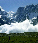
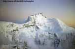
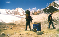
Central part of Pamir presents two giants for climbing: Communism (7495 m) and Korzhenevskoy (7105 m) peaks, which are standing in front of each other. Both of them has extra class routes and classical ones for easy climbing with pre acclimatisation as usual up to Pamirskoe Plateau. Peak I.Somoni (former Communism) (7495 m). Mt. I.Somoni (former Communism) This is an awe-inspiring rock and ice pyramid with a quadrangular base that has four distinct faces. The eastern one was climbed for the first time by Evgenii Abalakov in 1933 via a difficult route with a very complicated access, along the Bivuachniy (Bivouac) glacier On the western face is the classic route, Burevestnik, which runs along the ridge. The third face plunges down to the south for 2,000 meters on the Beliaeva glacier; it is quite steep characterized by the so called Puso (Paunch) a rock wall from 600 to 800 meters high with an incline of more than 80°. Here are the most difficult of 25 routes up Mt. Communism. (In the foto to the right) South-Western face of peak Communism, seen from the summit of Russia peak. The South-Western face was first climbed in 1968 by E. Mislovskiy, who kept to the right of the Puso. The true "Paunch" route was climbed only in 1977 by A. Nepomniashkiy. Later, other routes were opened by K. Valiev and V, Solonnikov. The face looking over the "Springboard" glacier has not been climbed yet. It is considered impossible to conquer because of the extremely dangerous icefall that descends onto the Pamirskoe plateau. The normal route up Mt. Communism, on the northern face, crosses the Pamirskoe plateau. This is one of the highest and largest plateaus in the world: about three km wide and twelve km long from west to east. The lowest point is at 4,700 meters altitude, the highest 6,300 m. At 6,000 m there is a little rocky peak called Parachutistov (Parachuters) in honour of the tragic expedition of Soviet military parachuters that was organized in 1967 for training and sporting purposes; many parachuters were killed when the strong wind caused them to crash against the rock, while the others managed to save their lives by opening their parachutes after they had passed over the wind belt. The Barodkin Route up Mt. Cornmunism (7,495 m, 5A) - from North side. Classical routes
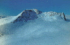
The normal route up Mt. Communism winds up from the Waltera glacier on to the northern face of the massif. It was opened in 1968 byJ. Barodkin along the ridge that bears his name. On a technical level it is not too difficult; it can be compared to the routes up Lenin Peak. Yet it is rated 5 A because of the high altitude. After careful acclimatization that includes a climb to the snow-covered Pamirskoe plateau and back, the route to the top takes about a week. (In the foto to the right) Northern slopes of peak Communism, seen from the glacier Waltera. It begins at the Moskvina base camp and goes up towards the south along the Waltera glacier, which you must cross in. a westerly direction after about a one-hour walk. Continue along the steep and rubbly ridge up to camp I, at ^,300 m, above the summit of the large rock triangle. In most cases this triangle is climbed over to the left, along the inclined ledge and the snow gully. This is the easiest way, but it is risky because it goes under the glacier icefall. From camp I the itinerary follows the rock ridge, which is often encrusted with ice, up to two snow domes called Grudi (Breasts, 6,200 m). In high season there are clear tracks of this part of the route, and in the more complicated sections a permanent rope has been set up. From here you have a level walk to camp 2 (6,200 m), which is in the Pamirskoe plateau. The third day you tackle the long crossing of the plateau, at the end of which you will find camp 3 by going up a snow ridge (6,400 m). The ascent continues along the ridge, up to the western shoulder of the summit, called Dushanbe (Great Barrier) Peak (6,956 m). Camp 4 is in a snow-covered col at 6,900 m. The route continues to the left over the snow under the summit rocks, up to the col. This is the most difficult part of the climb, because of the steepness and altitude. You reach the top by climbing up the final 300 meters along the northern ridge. You can descend to camp 4, or even camp 3, on the same day. The record for the fastest climb up Mt. Communism was set in 1990 by V. Obikhod and E. Klinezkiy, who took about 20 hours, without bivouacking, to get over the 3,300 meters difference in height, reach the summit and then go back to the base camp. The Yugoslav A. Stremeiy, who opened the Yugoslavs' Route up Mt. Everest, holds another record: in 1983 he skied down Mt. Communism along the Barodkin route. The Burevestnik Route up Mt. I.Somoni (formerCommunism) (7,495 m, 5A) - from West side
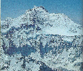
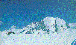
From the base camp on the Fortambek glaciel you cross the glacier (one hour) in the direction of the Burevestnik buttress, which leads to the Pamirskoe plateau. Once past the last crevasse, go over a rock wall that is not difficult and proceed up the debris and snow and ice slopes until you reach the buttress crest. This has debris that is interrupted by 2-3 mete walls that are easily negotiated; it leads to . small snowy plateau near the "Camel" gendarme (5,200 m). Here you can pitch camp 1. Continue along the ridge, moving on to the. steep snow and ice slope when necessary, until you reach the Parachutistov rocks. Leave these rocks to your left and climb up to the Pamirskoe plateau. I Tore you can set up camp 2 in snow cave (5,800 m). If you are well acclimatised, you can skip camp I and go directly to the plateau in 8 hours. Cross the plateau up to the base of the southwestern buttress of Dushanbe Peak (4-6 hours, depending on the condition of the snow); here you can set up camp 3 (6,f0 m). From here, go up the left-hand slope for a hour and over the last crevasse; then go to the rocks of the southwestern buttress, which . certain points are rubbly (40° incline). You arrive at Dushanbe (Great Barrier) Peak after going up a final snow and ice slope with a 40-45° incline; pitch camp in the plateau (6,900 m), behind the summit. Skirt the rock tower by bearing left, proceed along the little rock ridge, and then continue along the steep and difficult northeastern snow ridge (40° incline). Climb up the slope for the last 150 meters, and you will arrive at the top. For the descent, take the same route; it takes two days. The Route up Chetiriokh (6,299 m) and Vorobiova Peaks (5,691 m, 2A) (In the foto to the right) Panorama of peak Korzhenevskoy - peak Chetiriokh. Situated between the Moskvina and Waltera glaciers are these two lovely snow-capped peaks that offer a splendid view of the two 7,000 meter mountains. The first peak, Chetiriokh, is 6,299 m high. The route to its summit starts off from the Moskvina camp. Go up the Moskvina glacier for about two hours until you arrive at a little plateau. Opposite you will see the snow slope, which at first is not steep and then as it approaches the summit has an incline of 35-40°. Halfway up this slope, under a group of rocks, you can pitch your tents to bivouac. The climb, rated 4A, takes two days between ascent and descent and can be done on skis. Vorobiova Peak (5,691 m) is a large white dome with a magnificent view. You get there from the Moskvina camp: go up the Moskvina glacier moraine for about an hour, then up the stone slope that leads to the snow ridge (3 hours). You can bivouac here, but the climb to the top via the ridge and the descent can be done in one day. These routes arc used as training for the climbs up the 7,000 m mountains. The Route up Mt. Korjenevskoy (7,105 m, 5A) (In the foto to the right) peak Korjenevskoy, seen from Pamirskoe plateau.
The route along the southern crest (opened by V. Tsetkin in 1966) is not too difficult and can easily be climbed in three or four days after a suitable acclimatization period. From the Moskvina base camp, follow the path along the torrent that descends from the glacier on the southern side of the mountain, and then continue to the right and cross the Moskvina glacier. Continue along the rock and debris ridge until the slope becomes less steep; here, at about 3,200 meters, you can set up camp 1. Proceed along the glacier slope that descends on the southern side of the mountain. The glacier is steep, so that rope, crampons, ice axes and ice screws are necessary. Then the incline again becomes less steep and the route approaches the moraine; here, at 3,300 m, is another good place to set up camp 1. It is more comfortable, with a splendid view that also takes in the entire route. (In the photo to the right) peak Korjenevskoy with Pamirskoe plateau. You then go up the glacier along a slope that is not very steep; at the beginning of the season the glacier is covered with snow, but at the end deep crevasses open up. Then the face becomes steep, leading to a triangle of rocks where you can set up camp 2 (3,800 m) on a snowy terrace under an overhanging roof.
The route continues to the right, up to the little col, with a 1,000 meter crossing on ice that requires crampons, ice axes, rope and ice pitons. This is one of the most difficult and technical parts of the entire route. Usually a fixed rope is to be found there. The crossing ends on a rather gentle incline that arrives at the col on the southern ridge (6,100 m). You can pitch camp 2 here as well, but there is space only for a few tents. Then you must tackle a small fifty-meter tall face of steep rocks where there is a fixed rope. You come out on the snow ridge, which is long and easy but may be tiring because of the many ups and downs; this leads to the top. There is no need for crampons here, as the snow is usually soft and ski poles should suffice. Camp 3, where you will also stop on the way back down, can be set up either at 6,400 or 6,700 meters. The descent takes 24 hours. The view of Mt. Communism is fantastic.
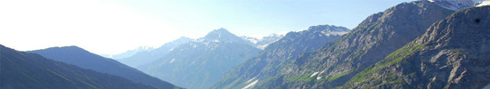
Peak Russia is situated near to Communism peak, joining to him by the vast high plateau "Pravda". Peak Moscow stands also near to Communism peak, but in the opposite side. In the base camp on the glacier Fortambek the North face of Moscow peak rising up in all its grandeur. It is rather difficult to get to other sides of Moscow peak, as only helicopter flight can be used for it. |
Last news
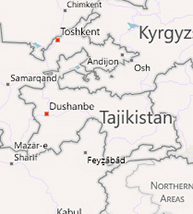
2017-03-08 VIST US AT ITB BERLIN 20172014-03-15 Pamir & mountain travel co.in ITB 20142012-12-06 Super Star Aquarius docks at Chan May port!Tajikistan map
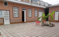
hotels
trekking in Fann mountain
transportations


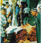
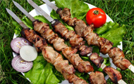
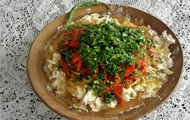
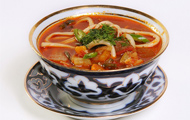
National meal
|


|
Hot tours
Site map
Weather in Tajikistan
Hotels booking
Search
|
About roof of PamirPamir- "the Roof of the World".
Enclosed between the Alai range to the south and east and by the Tien-Shan range to the north, the Ferghana valley is the fertile hear of these large mountains. When in the 3rd century B.C. the envoys of the Chinese emperor came to this region to see the celebrated Ferghana horses, whose speed was legendary throughout Asia, and to seek allies in order to control the trade routes, the valley had already been intensely cultivated and its towns were the most frequented oasis in the entire Silk Road. The thriving trade along the ancient Silk Road, as well as the many invasions on the part of foreign armies that came to the steppe for booty, developed the complex culture of Central AM. The most ancient inhabitants of this area descended from immigrants who had fled from Persia long before Alexander the Great time; they remained different from the other populations both in their language (which was linked to ancient Persian) and their work, which was traditionally agricultural. The Turkmen’s, Uzbeks, Kazakhs and Kyrgyz, who are of Mongolian stock, arrived later in the successive wavesof immigration or conquest, for centuries they concentrated on horse and sheep breeding. During the summer the shepherds slowly take their animals through the steppes towards the mountains. The Kyrgyz stop at the slopes of the Alai mountains, where they also train hunting falcons, or they move on to the slopes of the Pamirs and set up the traditional Central Asian tents, the yurts, which have been the dwellings of all the nomadic shepherds in this region for centuries. They are shaped like a wide cylinder with a low cone on top and are made of curved willow branches covered with thick felt. Inside, the "furniture" consists of a stove, a low table, many rugs and lots of embroidered cloth used to sleep and sit on, and to keep out the cold. The local shepherds were probably the guides for the first explorers of the Pamir range, when in the last century Great Britain and Russia, whose expanding, empires were approaching each other, decided to initiate a systematic study of the region in order to find the source of the Indus and Oxus (Amu Darya) rivers. Centuries before, Marco Polo had left the first description of the Pamirs; he had crossed them in the zone of present-day Afghanistan during, his legendary journey to Cathay, and among, other things he mentions the race of huge sheep that were later named after him. In 1866 the first Russian expedition arrived in Pamir, led by the naturalist and explorer Fedchenko, who explored the Zaalaiyskiy Mts. and discovered the immense glacier named after him that until recently was considered the largest in the world. Other Russian, English and Swedish expeditions followed. Towards the end of the last century the white zones on the maps of Central Asia gradually disappeared as more and more geographic and topographic information was furnished. But Pamir is still a wild region with many unknown and unconquered valleys and peaks. The Pamir is basically composed of Zaalaiysliy range with Lenin (7134 m) peak, Central part with Communism (7495 m) peak dominating - the most high point and Revolution (6974 m) peak part, and finally south-western Pamir with Engels (6510 m) and Marx rock towers grandeur. Lenin (7134 m) peak region Lenin (7134 m) peak - is situated in center of Zaalayskiy range of North-Western Pamir within famous Alay valley. Ismoili Somoni (Former Communism) (7495 m) - Korjenevskoy (7105 m) peaks region I.Somoni (Communism) (7495 m) and Korjenevskoy (7105 m) peaks are standing in Central Pamir in front of each other, inviting to make an ascent by not difficult routs. Revolution (6974 m) peak region South-Western Pamir region South-Western Pamir is situated in the border between Tajikistan and Afghanistan along the ancient Silk road. It presents a large number of towering rock massifs with more then 1000 meters faces high difficult for climbing. Communism - E. Korjenevskoy peaks region (map).
Central part of Pamir presents two giants for climbing: Communism (7495 m) and Korzhenevskoy (7105 m) peaks, which are standing in front of each other. Both of them has extra class routes and classical ones for easy climbing with pre acclimatisation as usual up to Pamirskoe Plateau. Peak I.Somoni (former Communism) (7495 m). Mt. I.Somoni (former Communism) This is an awe-inspiring rock and ice pyramid with a quadrangular base that has four distinct faces. The eastern one was climbed for the first time by Evgenii Abalakov in 1933 via a difficult route with a very complicated access, along the Bivuachniy (Bivouac) glacier On the western face is the classic route, Burevestnik, which runs along the ridge. The third face plunges down to the south for 2,000 meters on the Beliaeva glacier; it is quite steep characterized by the so called Puso (Paunch) a rock wall from 600 to 800 meters high with an incline of more than 80°. Here are the most difficult of 25 routes up Mt. Communism. (In the foto to the right) South-Western face of peak Communism, seen from the summit of Russia peak. The South-Western face was first climbed in 1968 by E. Mislovskiy, who kept to the right of the Puso. The true "Paunch" route was climbed only in 1977 by A. Nepomniashkiy. Later, other routes were opened by K. Valiev and V, Solonnikov. The face looking over the "Springboard" glacier has not been climbed yet. It is considered impossible to conquer because of the extremely dangerous icefall that descends onto the Pamirskoe plateau. The normal route up Mt. Communism, on the northern face, crosses the Pamirskoe plateau. This is one of the highest and largest plateaus in the world: about three km wide and twelve km long from west to east. The lowest point is at 4,700 meters altitude, the highest 6,300 m. At 6,000 m there is a little rocky peak called Parachutistov (Parachuters) in honour of the tragic expedition of Soviet military parachuters that was organized in 1967 for training and sporting purposes; many parachuters were killed when the strong wind caused them to crash against the rock, while the others managed to save their lives by opening their parachutes after they had passed over the wind belt. The Barodkin Route up Mt. Cornmunism (7,495 m, 5A) - from North side. Classical routes
The normal route up Mt. Communism winds up from the Waltera glacier on to the northern face of the massif. It was opened in 1968 byJ. Barodkin along the ridge that bears his name. On a technical level it is not too difficult; it can be compared to the routes up Lenin Peak. Yet it is rated 5 A because of the high altitude. After careful acclimatization that includes a climb to the snow-covered Pamirskoe plateau and back, the route to the top takes about a week. (In the foto to the right) Northern slopes of peak Communism, seen from the glacier Waltera. It begins at the Moskvina base camp and goes up towards the south along the Waltera glacier, which you must cross in. a westerly direction after about a one-hour walk. Continue along the steep and rubbly ridge up to camp I, at ^,300 m, above the summit of the large rock triangle. In most cases this triangle is climbed over to the left, along the inclined ledge and the snow gully. This is the easiest way, but it is risky because it goes under the glacier icefall. From camp I the itinerary follows the rock ridge, which is often encrusted with ice, up to two snow domes called Grudi (Breasts, 6,200 m). In high season there are clear tracks of this part of the route, and in the more complicated sections a permanent rope has been set up. From here you have a level walk to camp 2 (6,200 m), which is in the Pamirskoe plateau. The third day you tackle the long crossing of the plateau, at the end of which you will find camp 3 by going up a snow ridge (6,400 m). The ascent continues along the ridge, up to the western shoulder of the summit, called Dushanbe (Great Barrier) Peak (6,956 m). Camp 4 is in a snow-covered col at 6,900 m. The route continues to the left over the snow under the summit rocks, up to the col. This is the most difficult part of the climb, because of the steepness and altitude. You reach the top by climbing up the final 300 meters along the northern ridge. You can descend to camp 4, or even camp 3, on the same day. The record for the fastest climb up Mt. Communism was set in 1990 by V. Obikhod and E. Klinezkiy, who took about 20 hours, without bivouacking, to get over the 3,300 meters difference in height, reach the summit and then go back to the base camp. The Yugoslav A. Stremeiy, who opened the Yugoslavs' Route up Mt. Everest, holds another record: in 1983 he skied down Mt. Communism along the Barodkin route. The Burevestnik Route up Mt. I.Somoni (formerCommunism) (7,495 m, 5A) - from West side
From the base camp on the Fortambek glaciel you cross the glacier (one hour) in the direction of the Burevestnik buttress, which leads to the Pamirskoe plateau. Once past the last crevasse, go over a rock wall that is not difficult and proceed up the debris and snow and ice slopes until you reach the buttress crest. This has debris that is interrupted by 2-3 mete walls that are easily negotiated; it leads to . small snowy plateau near the "Camel" gendarme (5,200 m). Here you can pitch camp 1. Continue along the ridge, moving on to the. steep snow and ice slope when necessary, until you reach the Parachutistov rocks. Leave these rocks to your left and climb up to the Pamirskoe plateau. I Tore you can set up camp 2 in snow cave (5,800 m). If you are well acclimatised, you can skip camp I and go directly to the plateau in 8 hours. Cross the plateau up to the base of the southwestern buttress of Dushanbe Peak (4-6 hours, depending on the condition of the snow); here you can set up camp 3 (6,f0 m). From here, go up the left-hand slope for a hour and over the last crevasse; then go to the rocks of the southwestern buttress, which . certain points are rubbly (40° incline). You arrive at Dushanbe (Great Barrier) Peak after going up a final snow and ice slope with a 40-45° incline; pitch camp in the plateau (6,900 m), behind the summit. Skirt the rock tower by bearing left, proceed along the little rock ridge, and then continue along the steep and difficult northeastern snow ridge (40° incline). Climb up the slope for the last 150 meters, and you will arrive at the top. For the descent, take the same route; it takes two days. The Route up Chetiriokh (6,299 m) and Vorobiova Peaks (5,691 m, 2A) (In the foto to the right) Panorama of peak Korzhenevskoy - peak Chetiriokh. Situated between the Moskvina and Waltera glaciers are these two lovely snow-capped peaks that offer a splendid view of the two 7,000 meter mountains. The first peak, Chetiriokh, is 6,299 m high. The route to its summit starts off from the Moskvina camp. Go up the Moskvina glacier for about two hours until you arrive at a little plateau. Opposite you will see the snow slope, which at first is not steep and then as it approaches the summit has an incline of 35-40°. Halfway up this slope, under a group of rocks, you can pitch your tents to bivouac. The climb, rated 4A, takes two days between ascent and descent and can be done on skis. Vorobiova Peak (5,691 m) is a large white dome with a magnificent view. You get there from the Moskvina camp: go up the Moskvina glacier moraine for about an hour, then up the stone slope that leads to the snow ridge (3 hours). You can bivouac here, but the climb to the top via the ridge and the descent can be done in one day. These routes arc used as training for the climbs up the 7,000 m mountains. The Route up Mt. Korjenevskoy (7,105 m, 5A) (In the foto to the right) peak Korjenevskoy, seen from Pamirskoe plateau.
The route along the southern crest (opened by V. Tsetkin in 1966) is not too difficult and can easily be climbed in three or four days after a suitable acclimatization period. From the Moskvina base camp, follow the path along the torrent that descends from the glacier on the southern side of the mountain, and then continue to the right and cross the Moskvina glacier. Continue along the rock and debris ridge until the slope becomes less steep; here, at about 3,200 meters, you can set up camp 1. Proceed along the glacier slope that descends on the southern side of the mountain. The glacier is steep, so that rope, crampons, ice axes and ice screws are necessary. Then the incline again becomes less steep and the route approaches the moraine; here, at 3,300 m, is another good place to set up camp 1. It is more comfortable, with a splendid view that also takes in the entire route. (In the photo to the right) peak Korjenevskoy with Pamirskoe plateau. You then go up the glacier along a slope that is not very steep; at the beginning of the season the glacier is covered with snow, but at the end deep crevasses open up. Then the face becomes steep, leading to a triangle of rocks where you can set up camp 2 (3,800 m) on a snowy terrace under an overhanging roof.
The route continues to the right, up to the little col, with a 1,000 meter crossing on ice that requires crampons, ice axes, rope and ice pitons. This is one of the most difficult and technical parts of the entire route. Usually a fixed rope is to be found there. The crossing ends on a rather gentle incline that arrives at the col on the southern ridge (6,100 m). You can pitch camp 2 here as well, but there is space only for a few tents. Then you must tackle a small fifty-meter tall face of steep rocks where there is a fixed rope. You come out on the snow ridge, which is long and easy but may be tiring because of the many ups and downs; this leads to the top. There is no need for crampons here, as the snow is usually soft and ski poles should suffice. Camp 3, where you will also stop on the way back down, can be set up either at 6,400 or 6,700 meters. The descent takes 24 hours. The view of Mt. Communism is fantastic.
Peak Russia is situated near to Communism peak, joining to him by the vast high plateau "Pravda". Peak Moscow stands also near to Communism peak, but in the opposite side. In the base camp on the glacier Fortambek the North face of Moscow peak rising up in all its grandeur. It is rather difficult to get to other sides of Moscow peak, as only helicopter flight can be used for it. |
Last news
2017-03-08 VIST US AT ITB BERLIN 20172014-03-15 Pamir & mountain travel co.in ITB 20142012-12-06 Super Star Aquarius docks at Chan May port!Tajikistan map
hotels
trekking in Fann mountain
transportations
National meal
|